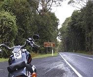
Over the hump
Here’s the latest (or at least most recent) way
of getting from the coast to the hills in NSW
Even in
particularly long history of road building, the
stripling. The last part of the main highway to be built was officially opened
on December 9, 1960. Even then there was bitumen on just 29 of its 73 miles.
That’s despite the road itself being quite old,
by our standards – but on a different alignment.
The road that would later become the Gwydir
Highway was first constructed and improved in 1867 at the request of the
Commissioner and Engineer for Roads in NSW who considered that “a good road via
Newton Boyd, if the difficulties were not too great, would be the proper to
adopt as a main road”.
The following year the road, connecting at that
stage Collarenebri and Grafton, was opened to full traffic and a steam ferry
was established across the
and Grafton, completing the link.
Bridges were built and the road was gradually
improved in other ways, but there was a problem. The section between
with several switchbacks at the aptly named Big Hill, just above Newton Boyd.
In 1935, it was decided that “rather than reconstruct
this section, with its steep grades, narrow cuttings and low standard of
alignment, to endeavour to locate a better route”. Widening the existing road (which
we rode and wrote about a few issues back here in ARR) would have been very expensive and would still not have
provided a satisfactory alignment on some sections.
A general reconnaissance survey was carried out
over a wide area in 1936 and this was followed by an aerial survey in 1937 – apparently
the first time the Department of Main Roads had used aerial photography for this
purpose in NSW.
It still wasn’t easy to find an alternative. If
you look at the map of the current alignment, you’ll see it deviates quite a
long way to the north. This was necessary to avoid several different road-building
problems that we won’t go into here. Suffice it to say that finding a new
alignment was a severe headache. The good news is that this new alignment has
provided a terrific motorcycle road that runs through open grazing country and
national park.
Construction of the new route began as
unemployment relief work in 1939, but then, as they say, came the War. Work was
postponed indefinitely. It resumed in December 1946, but was stopped again a
year later when it became more urgent and essential to build logging roads to
satisfy the demand for timber for housing. Then the DMR ran out of money and
construction didn’t start again until January 1955.
Five years later the road was finally open and
you can go and ride it now. It’s posted as National Route 38 all the way from
Grafton to near Walgett, but take a tip from us: forget about the section west
of Glen Innes, or at least beyond Warialda. It’s pretty flat out where the road
actually follows the river it was named after.
And be careful. Don’t pick up rusty Jones’s jam
tins. Oh, and watch for potholes. We rode the Gwydir recently and one of the
boys hit one that made a hole in his bike’s sump, releasing a steaming flow of
precious engine oil. Still, his left boot will be waterproof for a good long
time, which is useful up there where it rains quite a bit!
PT

Amoxicillin Aspirin Buy Cialis Real Viagra For Sale Online 178 Cialis 20 Mg Wechselwirkungen Phenergan Addiction