Darrell Lawrence does a superb job of matching our style
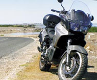
So, the Bear wants readers to write a travel story. How hard could it be? A bike (Aprilia Caponord – check), camera (Minolta – check) and few quotes from a classic author (um…right…Google – check). As William Shakespeare said: “That’s a valiant flea that dares eat his breakfast on the lip of a lion”, or a Bear in this case, but here goes.
Join me, if you will, on a journey through the Fleurieu Peninsula in South Australia to taste the flavours and see the history.
My favourite ride starts at the Wellington Ferry. For those coming from the east, you can follow the “southern ports” highway through Beachport, Robe, Kingston and Meningie. Those still awake after coming via the SE Freeway or Dukes Highway need to turn south on the outskirts of Tailem Bend.
The ferry began its life in 1937 as a private punt owned by George Morphett. It was replaced by the first government ferry to span the river in 1848. In 1841 a police station was set up and in 1846 “Morphetts Crossing” officially became Wellington – after the Duke of Wellington. In 1851 Alexander Tolmer, the Commissioner of Police, used Wellington as the crossing place for the gold escorts bringing the gold home from the Victorian gold fields.
As you leave the ferry, the old police station and court house, built in 1864, is on your right. Converted to a small café and B&B it is worth a stop for a coffee in the exercise yard and a browse through the photo display showing scenes from the lower Murray, including the day the Wellington Ferry sank, the 1956 floods and the building of the bridge at Murray Bridge. For the travel weary, accommodation is available (www.wellingtoncouthouse.com.au).
Travelling onward and westward, the turn on the left and tour around the small peninsula past Dunns Lagoon (also known as Ducks Hospital) to “The Point”. From here you can see Lake Alexandrina, Goose, Goat and Rat islands and the sandhills of the Coorong.
Out onto the road once more, the Clayton-Finnis road is a real delight with a good surface and lovely sweeping bends.
About 16km from Clayton, turn left for Currency Creek. This road drops steeply to the Finnis River with a ford crossing. In wet years, this crossing can flood, resulting in a detour through Finnis and around to the Strathalbyn Road.
Across the ford, a short squirt of about 300m brings you to the next ford – this is on a sharp corner and is blind due to the creek vegetation. Taking this corner too fast and wide will result in a steep fall and swim – you have been warned!
As you exit the ford (assuming you heeded my advice) you will notice an old gum tree in front of you. This is an old canoe tree. The Aboriginal people cut the bark from the tree to make a canoe and the scar can still be seen. There are several of these trees in the area and are reminders of the prosperous life the original inhabitants must have had before the white man changed the water situation forever.
A short and pleasant ride up the hill and on to Currency Creek brings you down to another ford crossing before climbing up to the Currency Creek Winery, another good place to stretch the legs and exercise the taste buds.
The road from here meets the Goolwa to Strathalbyn road and visitors are spoilt for choice. Those with time to spare can turn left to Goolwa, a small but busy town with a rich riverboat history; or go on to Victor Harbour, the famous Range Road to Delamere and Cape Jervis.
Others may choose to turn right and head back to Strathalbyn, or to Meadows via Bull Creek Road or even … well, they are all stories for another day.
ARR
